Layer 2: Spine + Entry — overlay analysis (2026-06-15)
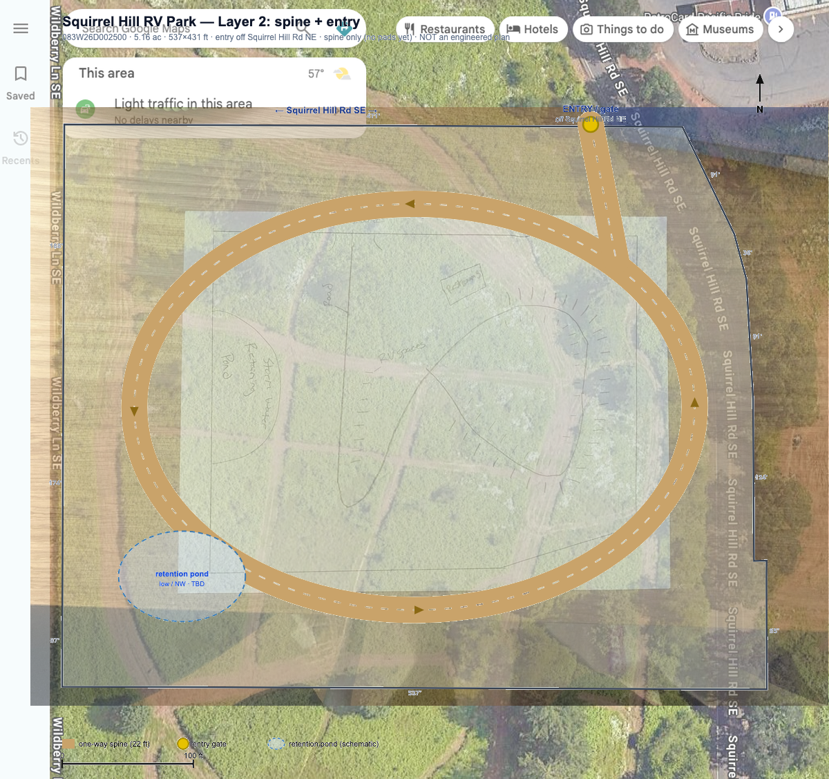
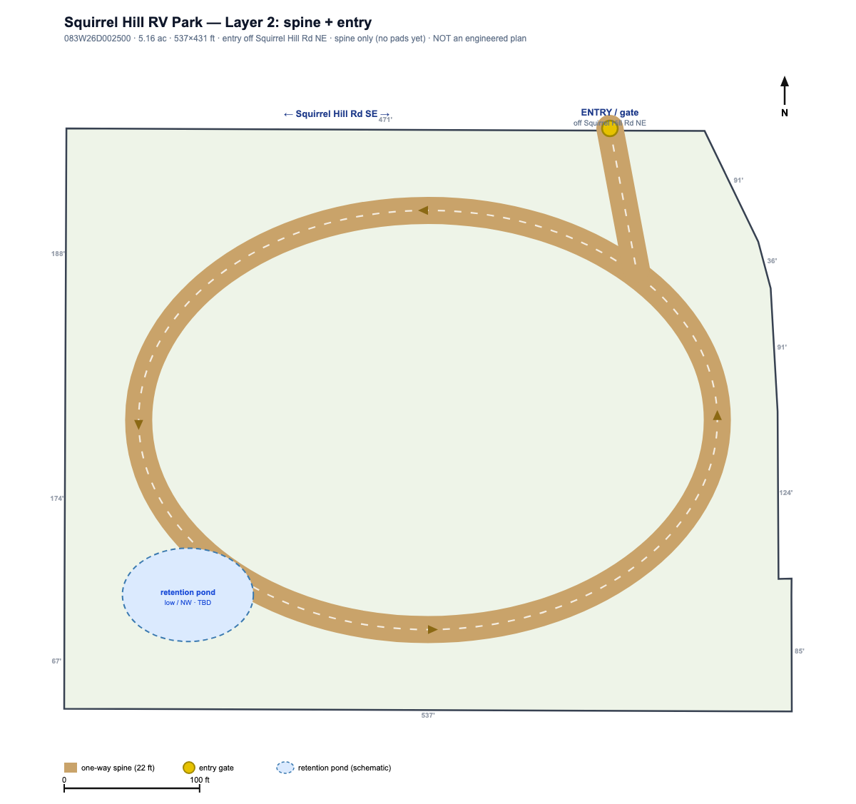
Overlay findings
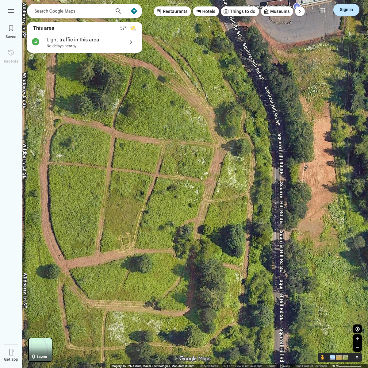
- Satellite ↔ drawing: good structural alignment. The parcel boundary polygon tracks the actual field edge in the aerial. The NE stair-step (where Squirrel Hill Rd curves around the corner) is visible as the red-brown gravel/road strip and our east boundary lands on it correctly.
- Cleared field matches loop placement. The large cleared oval/rectangular field visible in the satellite center is exactly where the loop spine was placed. Our loop fills that clearing without overrunning into the tree lines on the west or south.
- Entry point corroborated. The NE gate marker lands on what appears to be an existing road cut/opening in the satellite — the junction is visible in the aerial.
- Pond location corroborated. SW/NW corner of the satellite shows denser vegetation and darker soil tone, consistent with low/wet ground. All three sources agree: pond belongs in the NW quadrant.
- Loop may be slightly too far west. The cleared field in the satellite appears offset a bit east (toward the road) while our loop is mathematically centered. A ~50 ft eastward shift may tighten the fit.
- South edge setback concern. Satellite shows a band of existing vegetation at the south parcel boundary. Our loop bottom arc is close to that line — Rob's sketch likely has more setback here. Pad layout in Layer 3 should respect ~40–50 ft south buffer.
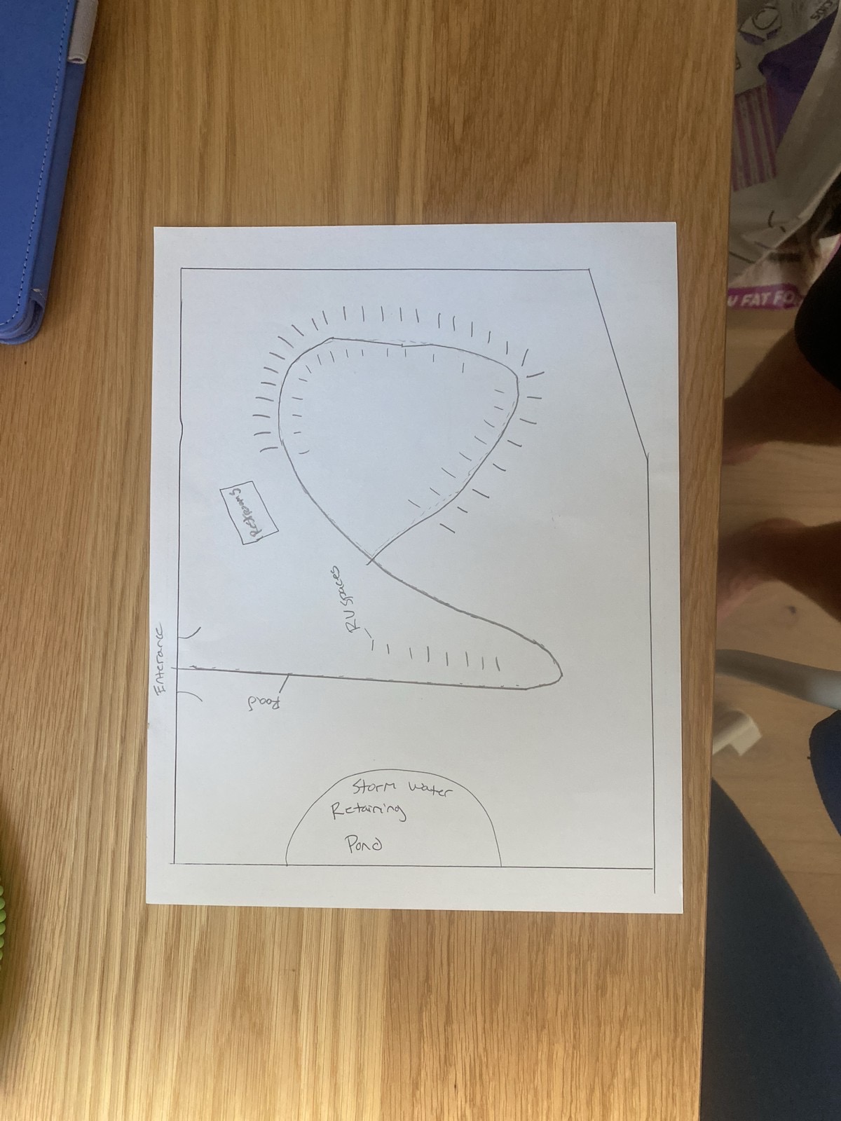
- Rob's sketch orientation confirmed: landscape (rotated 90° CW). Rob drew a roughly oval layout in landscape format. The portrait orientation doesn't fit the 537 × 431 ft parcel shape; landscape does.
Next: Layer 3 — add RV pad stalls along the interior/exterior of the loop, angled pull-in, targeting 70–80 stalls. Shift loop ~50 ft east to better match the cleared field. Hold ~40 ft south setback from vegetation.
⚠ Schematic only — not an engineered site plan. All geometry subject to civil/LiDAR review.
Concept layout — R. Cail's sketch, realized on the parcel
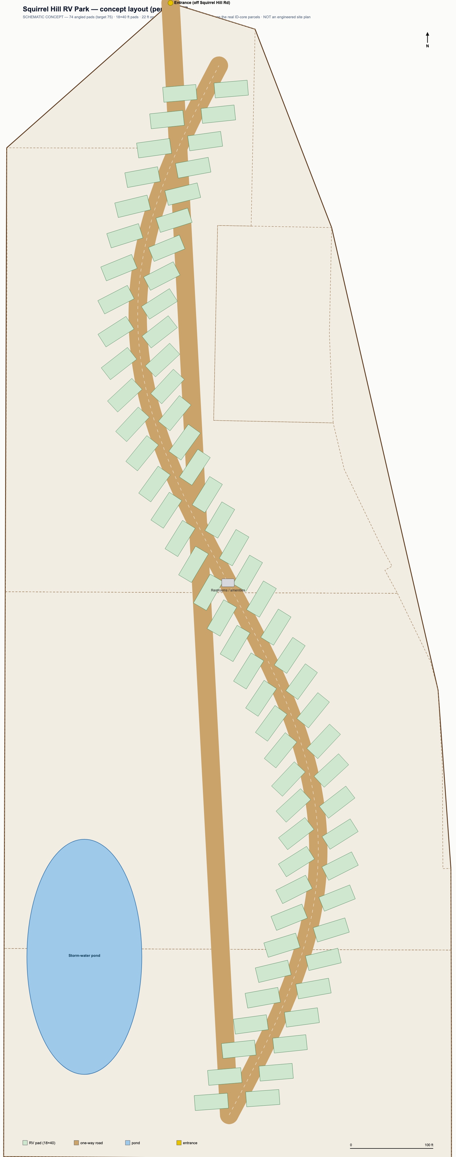
⚠ Schematic concept only — not an engineered site plan. Stall count, aisle widths, pad sizing, and grading still need a civil pass against the survey + LiDAR.
Property record
- Parcel / Tax acct
- 532952
- Taxlot
- 083W26D002500
- Owner
- AC SERVICES LLC
- Lot size
- 5.16 ac (224770 sf)
- Zoning
- ID
- Zoning authority
- MARION COUNTY
- Last sale
- 2024-02-26 · $125,000
- Real market value
- $229,270
- Assessed value
- $229,270
- Data quality
- marion_arcgis_authoritative
Program (interpreted from concept)
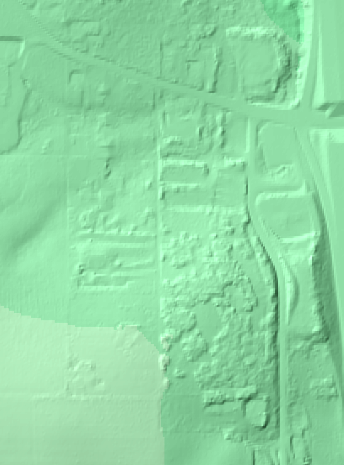
≈70–80-stall RV park on AC Services LLC's ID-zoned core at Delaney Rd × Squirrel Hill Rd SE (SE¼ Sec 26, Marion Co). Per the operator (Rob Cail, 2026-06-09): the site is ~3 parcels / ~13.4 ac — the Industrial-zoned core (the earlier 17.5 ac / 6 parcels over-counted by including the 2 AR Wildberry lots). Base zone ID is favorable for RV use. Layout: one-way loop + winding entry, angled pull-in pads, pond/stormwater at the NW low (~508 ft); the site climbs ~148 ft to the SE hill (~656 ft).
- 70–80rv padoperator target 70–80 stalls (denser than the ~50 in the first concept sketch)
- 1loop roadone-way oval circulation + winding entry drive
- 1entrygated entry off Delaney Rd / Squirrel Hill Rd SE
- 1water featurepond / stormwater detention at the NW low (~508 ft; existing catch basins + culverts already collect here)
- 2amenity buildingclubhouse/office + restroom/utility (lower/flatter ground)
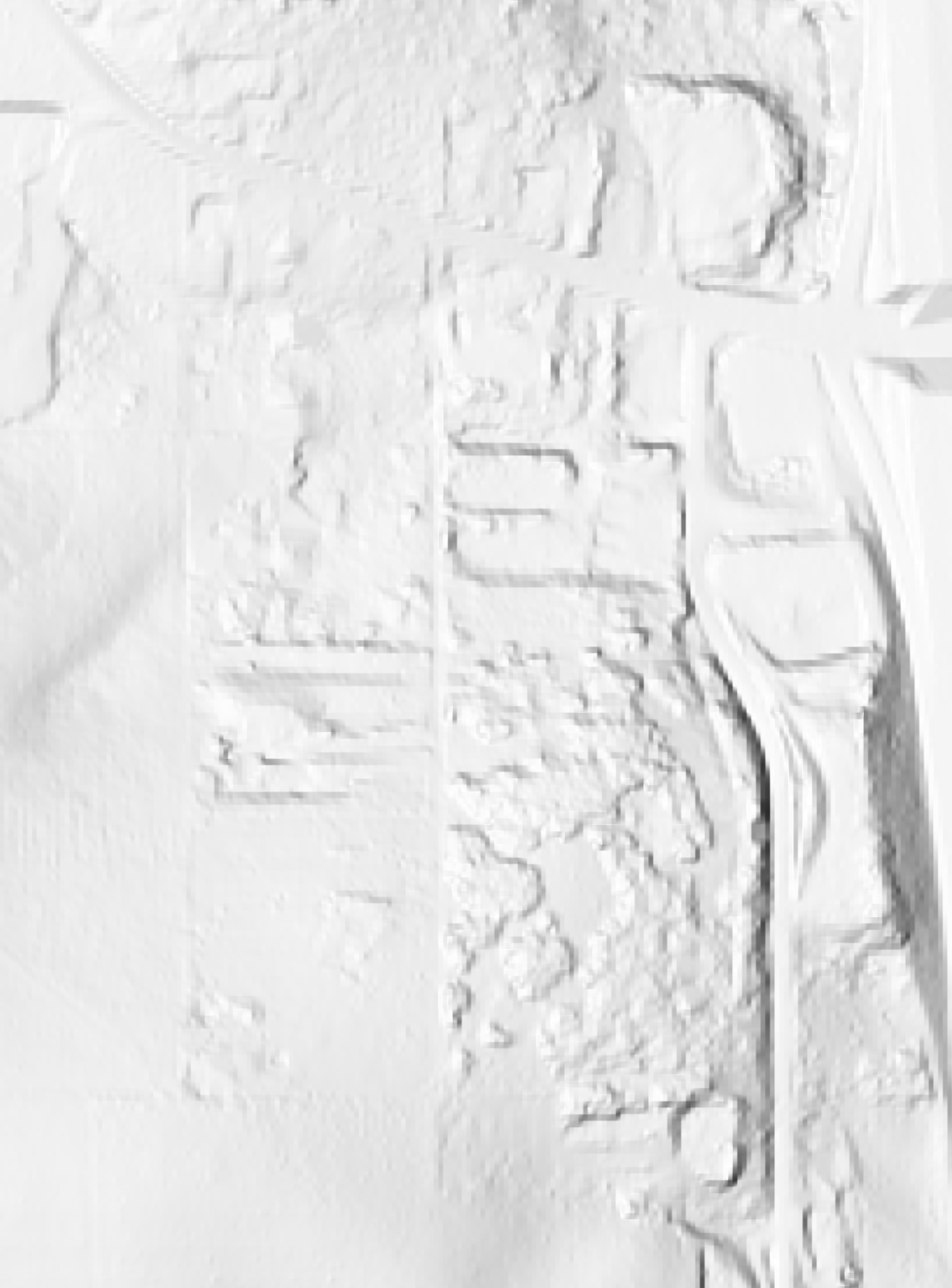
Capacity / fit: 70–80 stalls on ~13.4 ac is RV-park-typical density (~5–6 sites/ac including roads + amenities). Rough fit: ~3.5–4 ac of pads (70–80 × ~2,000 sf), ~1.2 ac of loop + entry drive, plus pond, two amenity buildings, setbacks and stormwater — workable on 13.4 ac with the steep SE hill left lower-density. Tighter than the 50-pad concept, so the loop should hug the LiDAR contours and stack pads on the gentler benches; pond stays at the NW low where the site already drains.
Source: Delaney Road RV Park FINAL.pdf (concept) + Topo Squirrel Hill Current.pdf (Land Markers topographic survey, Jan 2025)
Survey & topography
- Relief
- 508–656 ft (~148 ft)
- High point
- SE corner (Squirrel Hill) — ~656 ft
- Low / drainage
- NW corner at Delaney × Squirrel Hill Rd (~508 ft; catch basins + 12"/15" culverts) — natural pond/detention site
- Survey
- Land Markers Surveying — Troy E. Petersen, PLS 61408 (Salem OR)
- Dated
- 2025-01-08 (rev 2025-01-16), Job 24-147, scale 1"=100'
- Title report
- AmeriTitle prelim 622150AM (2024-02-01)
- Deed
- Reel 3570 / Pg 353, Marion County Deed Records
- Datum
- OR State Plane North NAD83(2011); elevations NAVD88 (Marion Co Survey 30340)
Easements: roadway easement — Reel 240/Pg 932; roadway easement — Reel 59/Pg 598; roadway easement (no width specified) — Reel 791/Pg 196; 16' power line easement — Reel 154/Pg 253; 30' wide right-of-way — Reel 59/Pg 598
Property & site imagery


Draft permit matrix — confirm each
| Permit / review | Agency | Status | Rationale |
|---|---|---|---|
| Land-use / Conditional Use review (RV/campground) | County Planning | TBD | RV parks are typically a conditional or limited use; confirm against the base zone. |
| On-site sewage (DEQ/county) or sanitary sewer connection | County/DEQ | TBD | 50+ pads need a sanitary strategy; septic feasibility vs. municipal sewer. |
| Water supply approval (well + water-right or municipal) | OWRD/County | TBD | Potable supply for the park; well water-right or city connection. |
| Stormwater management + grading permit | County | TBD | New impervious (pads, roads) + grading triggers stormwater + erosion control. |
| Road approach / access permit | County/ODOT | TBD | New/modified approach onto the public road requires an access permit. |
| Building permits — amenity structures | County/State | TBD | Clubhouse/office/restroom buildings are separate structural permits. |
| Electrical trade permit (site distribution + pedestals) | State/County | TBD | Pad power pedestals + site distribution. |
| Fire apparatus access + water supply review | Fire District | TBD | Loop road geometry + hydrant/water for fire access. |
Notes
OPERATOR CORRECTIONS (Rob Cail via Cliq, 2026-06-09): site = ~3 parcels / ~13.4 ac (the ID core), not 17.5/6; target 70–80 RV stalls (not ~50); operator layout sketch received (pending ingestion). Site = AC Services LLC "Squirrel Hill" assemblage, SE 1/4 of T8S R3W Sec 26, per Land Markers topo survey (Job 24-147, Jan 2025; AmeriTitle prelim 622150AM; deed Reel 3570/353). Core parcels (Marion taxlots): 083W26D002500 (5.16ac ID), 002200 (4.4ac ID), 002600 (3.12ac ID), 002201 (0.75ac ID, 7911 Squirrel Hill Rd SE), 001701 (2.1ac AR), 001700 (2.0ac AR) -- ~17.5 ac, mostly ID (Industrial). Base zone ID makes an RV park far more feasible than ag-zoned land (likely conditional/permitted -- confirm in Marion County ID zone code). Exact Parcel 1-6 to taxlot mapping pending the title report. DRAFT -- confirm before use.